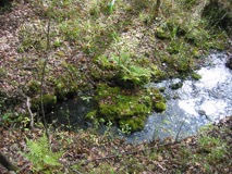
Ichetucknee Head Spring
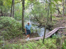
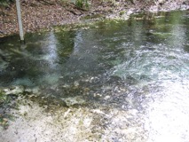
The Ichetucknee Head Spring is the beginning of the Ichetucknee River, The spring discharges from a cleft in the limestone (Figure 1). The spring pool is 102 feet east to west and 87 feet north to south, and 17 feet deep over the vent (Hornsby and Ceryak, 1998).
The head spring has a long and varied history. Native American artifacts have been found in the area surrounding the spring, as well as in the spring. Prior to development of the state park, the head spring area was the site of a youth camp and the Loncala Phosphate Company offices (Samuel Cole, 2008, pers. comm.).
This spring has been a popular swimming hole for decades (Figure 1). Beach sand had previously been brought into the area of the spring. This sand, along with broken rock and other debris, has since been removed by Park staff to restore the spring.
The median discharge based on 13 measurements from 1917 to 2002 is 23 cfs. Based on these data, the Head Spring is considered an historic second magnitude spring.
Cedar Head Spring

Mission Spring Group
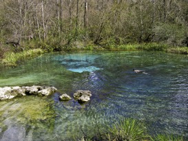
Devil’s Eye Spring
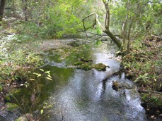
Devil’s Eye Spring (Figure 5) is also known as Boiling Spring. The spring consists of two vents and their pools off the west bank of the Ichetucknee River. The main pool is approximately 120 feet wide. The center vent is a limestone opening roughly 15 feet deep. The secondary pool is just upriver of the main spring.
Water flows from a limestone wall beneath the surface and forms a pool approximately 25 feet in diameter. The combined flow from the two spring vents forms a run 50 feet wide and 160 feet long (Scott et al., 2004; Follman & Buchanan, 2005).
The Devil’s Eye Spring is an historic second magnitude spring. The historic median discharge was approximately 48 cfs).
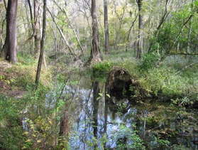
Grassy Hole Spring
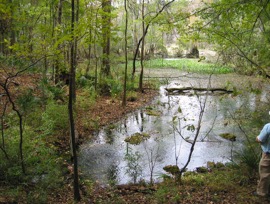
Grassy Hole spring is on the east bank of the Ichetucknee River. The spring pool (Figure 6) has two vents, is 12 feet wide and 2-3 feet deep, and vegetation covers the bottom. The spring run is shallow and approximately 200 feet long (Scott et al., 2004).
Access to the spring and run are restricted by the Park Service (Follman & Buchanan, 2005).
Hornsby and Ceryak (1998) estimated discharge to be 10 cfs. Based on three historic measurements, the median discharge is 1.8 cfs. This makes Grassy Hole Spring a third magnitude spring.
Mill Pond Spring
Coffee Spring