
The River System:
Ichetucknee River and Springs
by Sam B. Upchurch, Ph.D., P.G. 004 (Retired, Land O'Lakes, Florida)
THE ICHETUCKNEE RIVER is one of two main tributaries of the Lower Santa Fe River (the other being Olustee Creek). The Ichetucknee River begins at the Ichetucknee (Head) Spring, is fed by several other springs, and then flows into the Santa Fe River approximately 6 miles to the southwest. The river is essentially a large spring run as most of the water in the river under normal conditions is derived from springs at the upper extent of the river. The springs and much of the river are located in the Ichetucknee Springs State Park.
Altogether, the springs and river have a median discharge of over 356 cubic feet per second (cfs). The springs and most of the river are within Ichetucknee Springs State Park, which is considered by many to be the “Crown Jewel” of the state park system. The following sections briefly discuss the eight mapped springs in order from north to south.
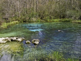
Ichetucknee Head Spring
The Ichetucknee Head Spring is the beginning of the Ichetucknee River, The spring discharges from a cleft in the limestone (Figure 1). The spring pool is 102 feet east to west and 87 feet north to south, and 17 feet deep over the vent (Hornsby and Ceryak, 1998).
The head spring has a long and varied history. Native American artifacts have been found in the area surrounding the spring, as well as in the spring. Prior to development of the state park, the head spring area was the site of a youth camp and the Loncala Phosphate Company offices (Samuel Cole, 2008, pers. comm.).
This spring has been a popular swimming hole for decades (Figure 1). Beach sand had previously been brought into the area of the spring. This sand, along with broken rock and other debris, has since been removed by Park staff to restore the spring.
The median discharge based on 13 measurements from 1917 to 2002 is 23 cfs. Based on these data, the Head Spring is considered an historic second magnitude spring.
Cedar Head Spring
Mission Spring Group
Mission Spring Group
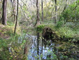
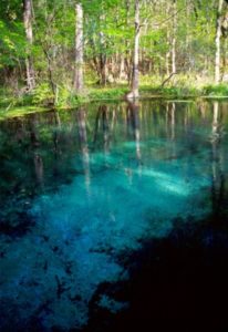
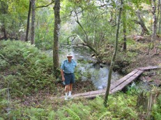
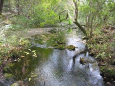
The Mission Spring Group consists of at least 8 vents near the southeast corner of Fig Island. The flow from these springs is split and it passes around an island on its way northwest to the Ichetucknee River. The name comes from a Spanish mission that existed north of the springs in the 1700s (Weisman, 1992). Prior to discovery of the mission, the springs were known as Fig Spring.
The spring on the north side of Fig Island is also known as Roaring Spring (Figure 4a; Scott et al., 2004). Roaring Spring, the largest of the Mission Springs Group, discharges from a cavern in a ledge of limestone on the north side Fig Island. The spring pool is about 10 feet east to west and 15 feet north to south. Depth near the ledge is 15 feet (Scott et al., 2004). The smaller spring located south of the island is known as Singing Spring.
Discharge data from Mission Springs appear to reflect Roaring Spring discharge, not the combined flow of Roaring Spring and Singing Spring. Historic measurements of spring discharge have been limited with a median flow of about 67 cfs. Therefore, the spring is an historic second magnitude spring.
Devil’s Eye Spring
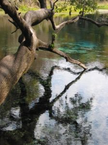
Devil’s Eye Spring (Figure 5) is also known as Boiling Spring. The spring consists of two vents and their pools off the west bank of the Ichetucknee River. The main pool is approximately 120 feet wide. The center vent is a limestone opening roughly 15 feet deep. The secondary pool is just upriver of the main spring.
Water flows from a limestone wall beneath the surface and forms a pool approximately 25 feet in diameter. The combined flow from the two spring vents forms a run 50 feet wide and 160 feet long (Scott et al., 2004; Follman & Buchanan, 2005).
The Devil’s Eye Spring is an historic second magnitude spring. The historic median discharge was approximately 48 cfs).
Grassy Hole Spring
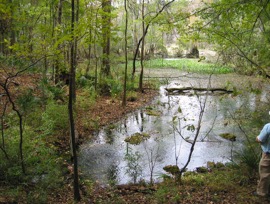
Grassy Hole spring is on the east bank of the Ichetucknee River. The spring pool (Figure 6) has two vents, is 12 feet wide and 2-3 feet deep, and vegetation covers the bottom. The spring run is shallow and approximately 200 feet long (Scott et al., 2004).
Access to the spring and run are restricted by the Park Service (Follman & Buchanan, 2005).
Hornsby and Ceryak (1998) estimated discharge to be 10 cfs. Based on three historic measurements, the median discharge is 1.8 cfs. This makes Grassy Hole Spring a third magnitude spring.
Mill Pond Spring
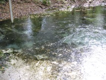
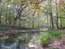
Mill Pond Spring (Figures 7a and 7b) is 150 feet downstream from Grassy Hole Spring, on the east side of the river. The name of the spring refers to the ruins of a mill located at the site. The run was modified by construction of an earthen dam in the 1800’s to funnel water to power an undershot water wheel at the grist mill. A cut that was excavated for the mill race is preserved on the south side of the run.
The spring pool has three vents and is approximately 45 feet wide and a maximum of 5 feet deep (Hornsby and Ceryak, 1998; Scott et al., 2004). The run is shallow and 150 feet long (Hornsby and Ceryak, 1998).
There are five historical measurements of discharge from Mill Pond Spring. Based on these measurements, the spring is a low second magnitude spring with median flow of 20 cfs.
Coffee Spring
Coffee Spring
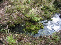
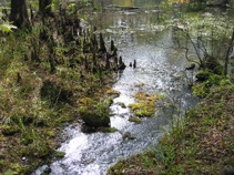
Coffee Spring (Figures 8a and 8b) is approximately one mile downriver from Mill Pond Spring on the west side of the river. The spring has a C-shaped pool on the west bank of the river. There are two main vents. The larger, upstream flow and the smaller, downstream flow both emerge from limestone openings and flow over a rocky run into the spring pool, roughly 30 to 35 feet from the river (Hornsby and Ceryak, 1998; Scott et al., 2004).
This spring is the only known habitat of the endemic Ichetucknee Siltsnail (Cincinnatia mica). The microscopic snail lives within the sediment in a small area near the confluence of the spring run with the river (Figure 8b). This area is located at an elevation that is several feet below the spring and under the influence of the river rather than spring discharge.
Coffee Spring is an historic third magnitude spring. Discharge was measured in 1998 at 2.8 cfs (Hornsby and Ceryak, 1998).
It is unclear whether the source of the water is the upper Floridan aquifer or a carbonate stratum in the Miocene Hawthorn Group. Champion and Upchurch (2003) used groundwater quality to identify the sources of groundwater for each of the Ichetucknee springs. They were unable to confidently attribute the discharge from Coffee Spring to any of the geochemical domains they identified in the springshed.
References Cited
Champion, K.M., and S.B. Upchurch, 2003. Delineation of Spring-Water Source Areas in the Ichetucknee Springshed. Tallahassee, Florida Department of Environmental Protection, Division of State Lands, 45 p.
Follman, J., and R. Buchanan (2015). Springs fever: A field & recreation guide to 500 Florida springs. 2nd Ed, accessed 11/16/2015 at http://springsfever.org/Springbook/index.html.
Hornsby, D., and R. Ceryak, 1998. Springs of the Suwannee River Basin in Florida. Suwannee River Water Management District, WR99-02, 178 p. [Publication available at http://www.srwmd.state.fl.us]
Rosenau, J.C., G.L. Faulkner, C.W. Hendry, Jr., and R.W. Hull, 1977. Springs of Florida. Florida Bureau of Geology Bulletin 31 (Revised), 461 p.
Scott, T.M., G.H. Means, R.P. Meegan, R.C. Means, S.B. Upchurch, R.E. Copeland, J. Jones, T. Roberts, and A. Willet, 2004. Springs of Florida. Florida Geological Survey, Bulletin No. 66, 377 p. plus CD ROM.
Weisman, B.R., 1992. Excavations on the Franciscan Frontier: Archaeology at the Fig Springs Mission. Gainesville, Florida, University Press of Florida, 267 p.